On Lake Como, there is a place where the sound of motorboats fades away and only the water remains. The steep slopes shape the scene: houses clinging to the rock, narrow lanes, old mule tracks and a gorge where two streams meet before plunging towards the lake.
The result is a striking orrido – a steep, narrow ravine – with a waterfall dropping for more than 200 metres and a stone bridge reached via a long staircase. It is a break along the road between Como and Bellagio, with a lesser-known extra just above the village: Onzanigo and the Val de Tuf.
Why Nesso is worth a detour between Como and Bellagio
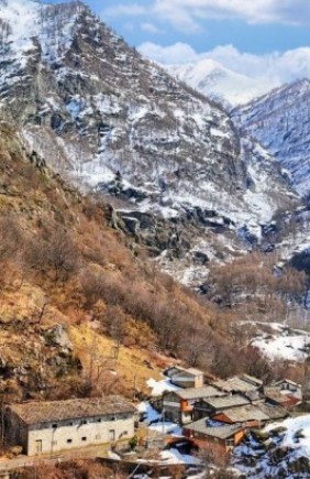
Nesso spreads across the slopes of the Triangolo Lariano, along the provincial road linking Como and Bellagio. It is not a single settlement, but a patchwork of frazioni, or small hamlets, which show how every metre of hillside was put to use for centuries.
Water is what links it all together. The Tuf and Nosée streams have carved out a deep gorge that opens straight onto the lake, creating one of Lake Como’s most memorable views. There are two sides to a visit here: the force of the orrido itself and the ingenuity of those who turned its waterfalls into power for mills and workshops.
The heart of the gorge: the orrido and Ponte della Civera
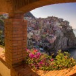
The easiest viewpoint is in Piazza Castello, a small lookout in the middle of the village. It takes in the entrance to the gorge, the stone bridge crossing it and the blue expanse of the lake in a single glance. The perspective is tight, with rooftops, rock, water and a network of stairways descending towards the shore.
The final stretch puts the legs to work. Around 340 evenly spaced steps lead down to the water between stone parapets and sudden glimpses into the gorge. At the bottom, a portico leads to the Ponte della Civera, a masonry arch connecting the hamlets of Coatesa and Riva del Castello.
Local tradition traces its origins to antiquity and is often described as Roman. The waterfall appears at an angle in a crack in the mountainside, breaks over the rocks and pours into the lake just metres from the bridge.
Traces of mills and silk production along the gorge
The orrido is not just a natural feature. Look closely at the ravine walls, and there are foundations, wheels and metal structures: remnants of the period when water power drove mills, hammers, presses and workshops connected with silk processing. They are small signs of a working landscape shaped carefully around its geography.
Prominent travellers and scholars also noticed this force. In notes within the Codex Atlanticus, Leonardo da Vinci mentioned Nesso’s “mountain fissure” as a recommended stop on Lake Como during the months of high water.
Nesso on the slopes: hamlets, churches and Castello di San Lorenzo
The village is made up of several settlements with different roles. North of Colmenace lies Borgovecchio, the oldest part, with tightly clustered buildings and narrow lanes.
Coatesa extends between the mouth of the Colmenace and the orrido, forming Nesso’s most familiar view: stone houses that almost touch the water and sit only metres from the waterfall.
Higher up is Lissogno, which grew beside the Tuf stream to make use of its power, while the Castello outcrop takes its name from the fortification that controlled travel and trade on the lake for centuries.
Today, Castello di San Lorenzo survives as a stone wall around 15 metres high. The small towers and swallowtail battlements seen from the lake were added during the 19th century, evoking the original defensive system.
The Strada Regia today: 30 km between lake and woodland
The old Strada Regia runs through the whole of Nesso. This network of mule tracks linked the villages of the Triangolo Lariano before lakeside carriage roads were built.
Today, it is a hiking route of more than 30 kilometres between Como and Bellagio, suitable for walking and cycling, with lake views, woodland sections and rural hamlets that remain largely intact.
Onzanigo and Val de Tuf: mills and emerald-green pools
Just above Nesso, along the road towards Zelbio and Piano del Tivano, Onzanigo shows another side of the village. The lake is no longer in sight, but the Nosée stream plunges into the cool Val de Tuf. By the 16th century, this settlement already had around twenty buildings, with two mills and a stamping mill serving local craft work.
A woodland path follows the Nosée to the Punt de Nusee, where the stream runs over pale slabs of rock and forms deep pools with emerald-green and blue reflections. During summer, the shade of hazel trees and the damp valley floor create a naturally cool stopping point. In spring, the water is more forceful, and its sound echoes around the valley walls.
Article originally published on The Wom Travel: In Lombardia c’è un borgo verticale nascosto tra cascate e ponti romani: ecco dove